Archives

North America

Blue Ridge Parkway

DSC01106The Blue Ridge Parkway running mostly along the spine of the Blue Ridge; a mountain chain which is a part of the Appalachian Mountains is America’s longest linear park.

It stretches from Virginia to Cherokee Indian Reservation in North Carolina and the border of the Smokey Mountains, Tennessee. An incredibly beautiful drive everyone should experience! No big trucks allowed and with the speed limit at 45m/hr it feels like you are the only vehicle on the road…for the entire 469 miles (755 km)!

The roadway continues through Shenandoah as Skyline Drive, a similar scenic road which is managed by a different National Park Service unit. Both Skyline Drive and the Virginia portion of the Blue Ridge Parkway are part of Virginia State Route 48.

DSC00796

DSC00956

DSC00938

DSC00930

DSC00690

DSC00682

DSC01189

DSC01000

DSC00978

Algonquin Park

October 7th, and the leaves are just past peak colour in Algonquin Park.

OLYMPUS DIGITAL CAMERA

Lake of Bays, from Bristlecone Lodge, offers a spectacular view at sunrise.

Dwight Bristlecone CottageOLYMPUS DIGITAL CAMERA

And the vistas along the Centennial Ridges, 10.4km Trail were, each one, more breathtaking than the previous, all looking west over the crowded park.

Fall Algonquin Park

Fall Algonquin Park


Lake Superior and Lake Michigan

When I thought of a beach destination, Michigan was nowhere on the list. Two week car trip with Sean and three kids, five amazing national and state parks later, having discovered the incredible vistas around Lake Superior and Lake Michigan, the word Michigan will, to me, forever have different connotation.

Pictured Rocks National Lakeshore, has an incredibly diverse landscape. At the west end of Grand Sable Dunes just before Au Sable Point is the area know as Log Slide. Easily descended, it can take up to an hour to climb back up. Legend has it that logs sent down the dry log chute would generate enough friction to cause the chute to catch fire. Today the chute is gas the one, but it attracts people of all ages stories still linger.

OLYMPUS DIGITAL CAMERALake Superior

OLYMPUS DIGITAL CAMERA

The kids did the climb back up in 15mins, having dipped their toes in the clear water of Lake Superior.

OLYMPUS DIGITAL CAMERA

The 10mile (16km) hike, and kids longest hike ever!!!,  took us along a winding path overlooking multicoloured rocks, once in a while offering a glimpse of a rock “castle” or a plateau.

OLYMPUS DIGITAL CAMERA OLYMPUS DIGITAL CAMERA

The Porcupine Mountain Wilderness State Park, located further west on Michigan’s Upper Peninsula, on the shores of Lake Superior, is home to the largest tract of old-growth hardwood forests west of the Adirondacks.  With spectacular waterfalls and lakes, 21 miles of pristine beaches, numerous lighthouses it offered too many choices for our short stay. We did manage to hike around the beautiful Lake of Clouds, though the sunny day meant that there were no clouds covering the lake that day.

OLYMPUS DIGITAL CAMERA

Leaving the Up (Upper Peninsula), we drove down to Dells for some waterpark fun for the kids. Then crossing Lake Michigan on The Lake Express High Speed Ferry, 2 1/2 hours later we drove off in Muskegon and kept going towards Silverlake State Park. This one was a mind-blowing playground for dune buggies and boys/jedies who like to pretend they are on planet Tatooine.

Silver lake State Park

Silver Lake State Park; morning view from campsite.

OLYMPUS DIGITAL CAMERA

OLYMPUS DIGITAL CAMERA

Driving another two hours north along the 22 scenic highway we drove into yet another dune wonderland. Sleeping Bear Dunes National Lakeshore was yet another dune adventure.

The incredibly blue and clear lake Michigan water made the 2mile ( 3km) hike over the scorching dunes well worth the effort… even though at times we were close to turning back. The 27 markers along the way were an encouragement and kept us going… only 13 more to go….!!

OLYMPUS DIGITAL CAMERA

OLYMPUS DIGITAL CAMERA

OLYMPUS DIGITAL CAMERA

OLYMPUS DIGITAL CAMERA

Gros Morne National Park

Newfoundland never ceases to disappoint, and having finally made the trip out to Gros Morne National Park; UNESCO world heritage site, I continue to be humbled by the beauty of yet another beautiful place in this incredible province.

The second largest Park in eastern Canada, spanning at 1,805 kmof western Newfoundland , Gros Morne is a part of the towering Long Range Mountains.

Gros Morne

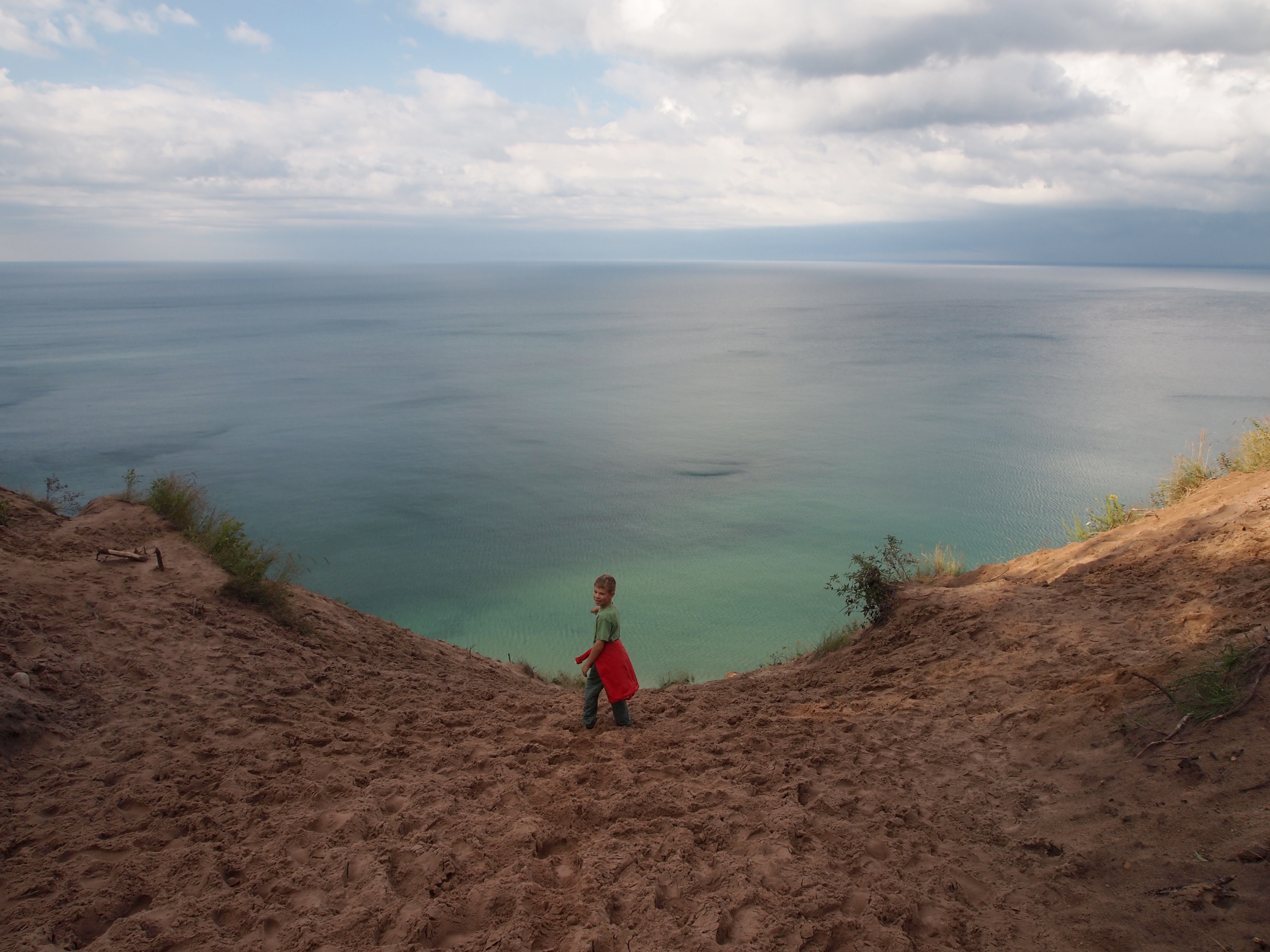
Making Trout River Campground, in the southern part of the park, our base, Sean, Alexander and I explored its diverse landscapes over a few days, juggling hikes and scenic drives, through various weather conditions.

OLYMPUS DIGITAL CAMERA

Tablelands Trail: This 4-km, trail show cases a time when the continents of Africa and North America collided, pushing rocks originally beneath the ocean to their present position on land. Ending at a waterfall you can turn back or keep hiking up the earth’s mantle, to the top of the tablelands for an expansive vista. Adding on another two hours we took the challenge and scrambled up rocks, reaching almost to the last remaining patches of snow.

On the short drive back the campsite, we watched as the setting sun lit up the tablelands giving them a golden glow.

OLYMPUS DIGITAL CAMERA

OLYMPUS DIGITAL CAMERA

The constantly changing weather provided amazing clouds that enveloped the mountains, hills and lakes, and just as quickly released them from its hold.

OLYMPUS DIGITAL CAMERA

The lazy day hike was a 3km stroll on a boardwalk over marshes, ending at a dock on Western Brook Pond. There we took a boat between stunning glacier-carved rock walls, on a ten-mile long lake also called a freshwater fjord.

OLYMPUS DIGITAL CAMERA

OLYMPUS DIGITAL CAMERA

14km Trout River Pond Hike; one of the least traversed hikes in the park, took us through 4km of low-lying forest and along the lake, eventually coming out onto open, rocky plains and ending at the trail head with a quick lunch before heading back to Trout River Campground.

Trout River Hike Gros Morne

OLYMPUS DIGITAL CAMERA

The Lookout Trail was a steady uphill climb, in parts along a boardwalk, emerging on a plateau with breathtaking view of Gros Morne Mountain from Partridgeberry Hill.

OLYMPUS DIGITAL CAMERA

OLYMPUS DIGITAL CAMERA

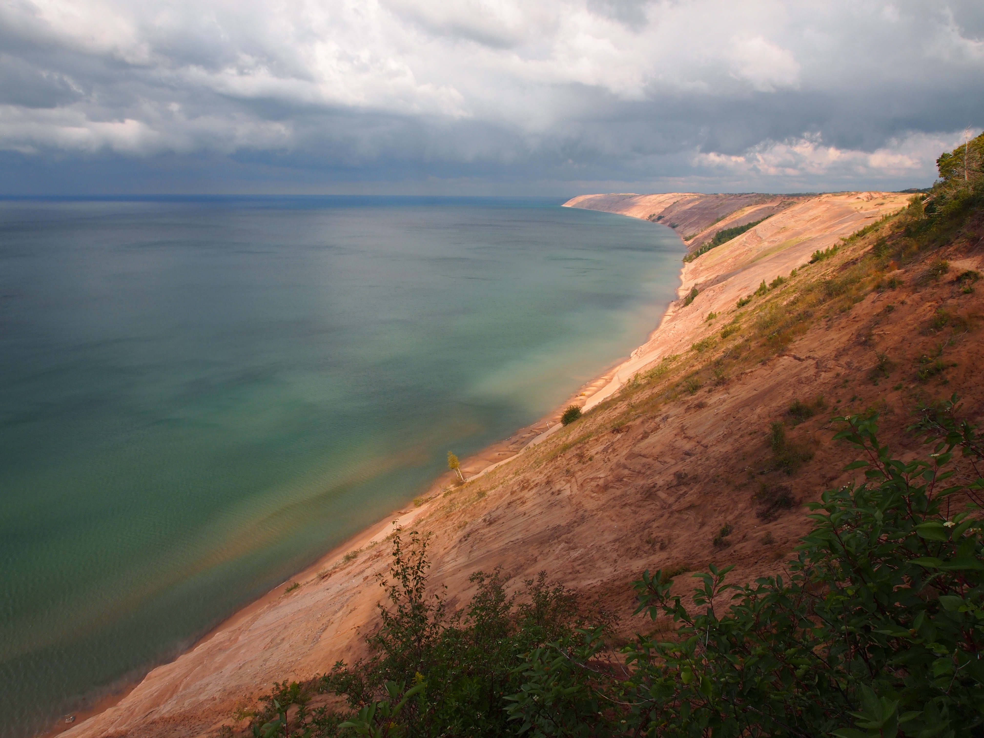
The North side of the park had a completely different landscape, with a rugged coastline. The 6km return Coastal Trail once connected two small fishing communities: Bakers Brook and Green Point and leads you by cobble beaches, through dense coastal stunted forests known locally as “tuckamore.”

OLYMPUS DIGITAL CAMERA

OLYMPUS DIGITAL CAMERA

OLYMPUS DIGITAL CAMERA

At low tide the limestone conglomerate at Cow Head is exposed to reveal layers, worn by waves into rugged shelves and cliffs marking the collapse of an ancient tropical reef.
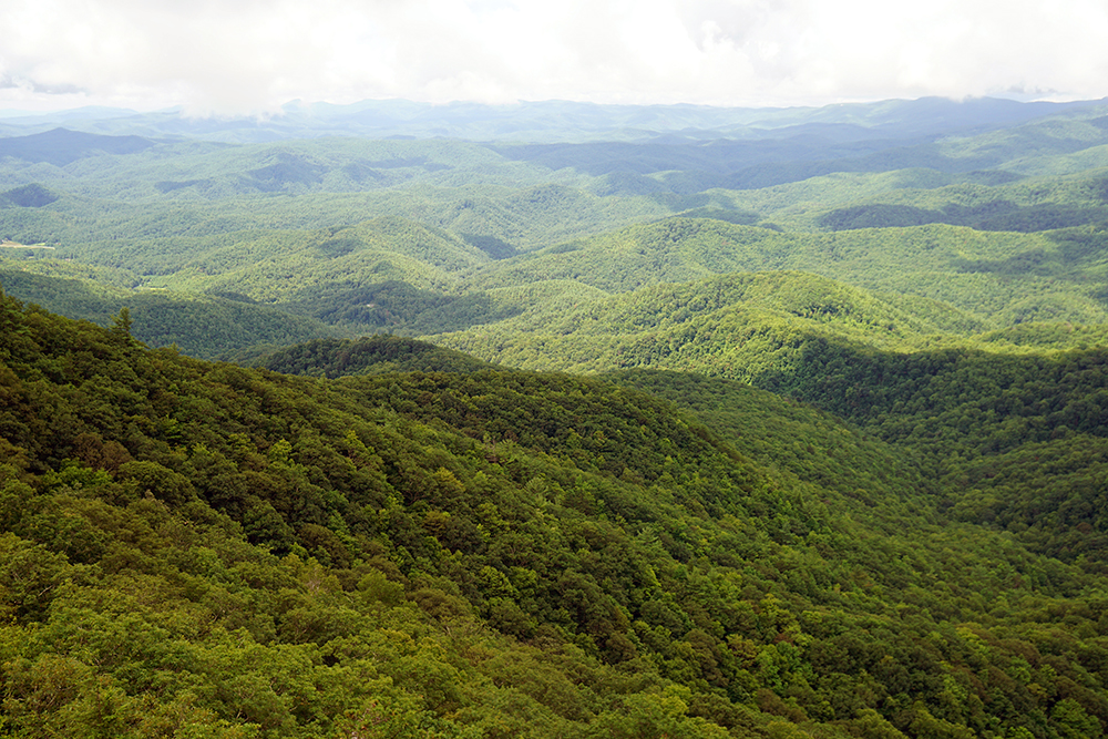
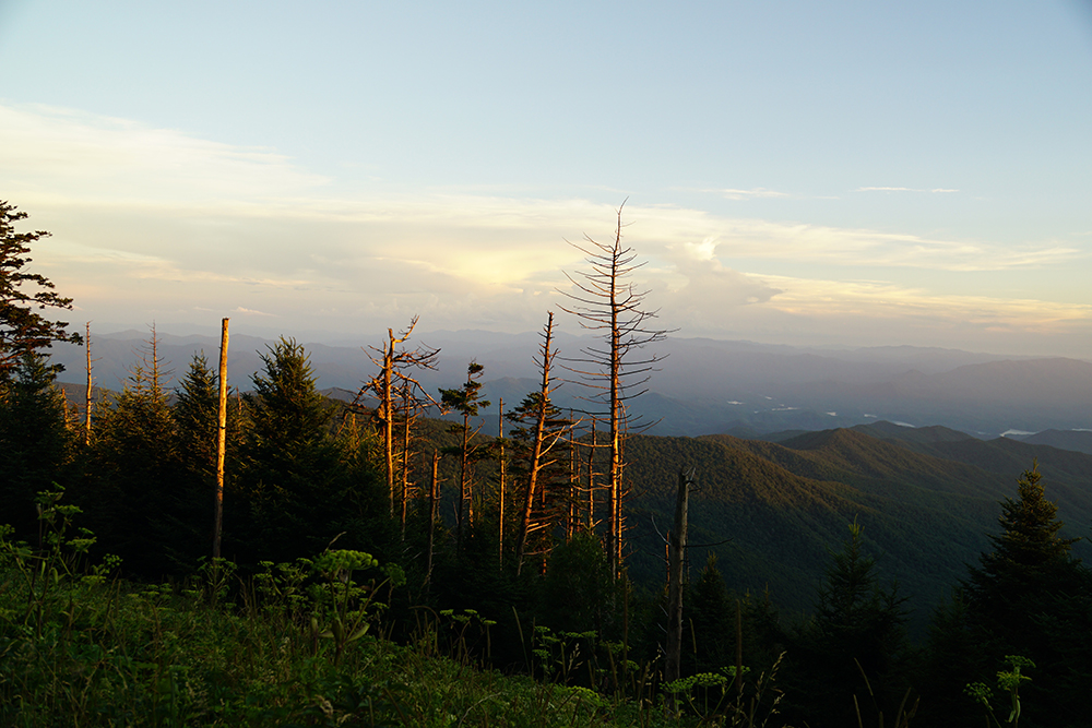
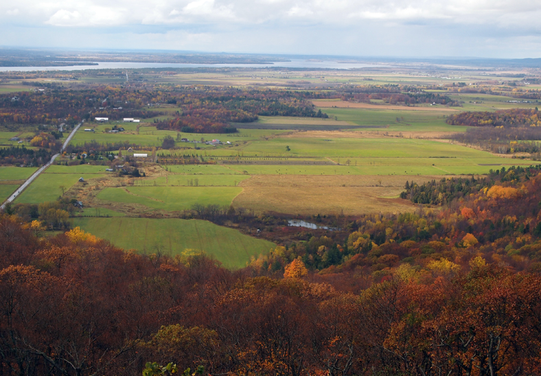
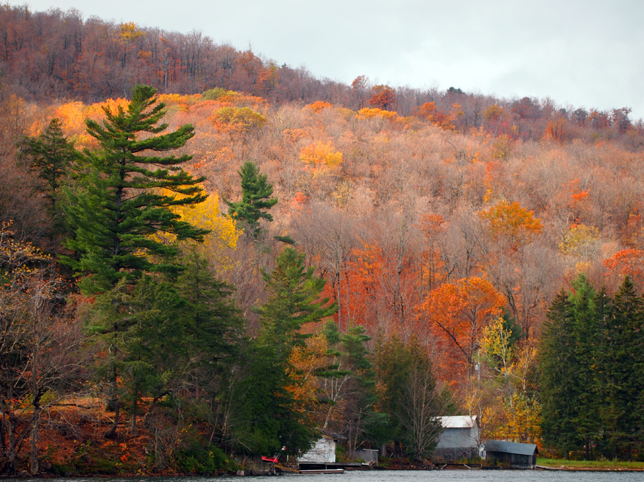
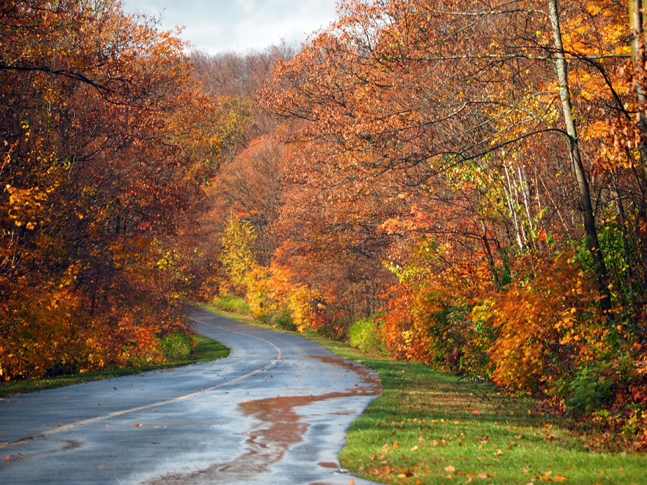
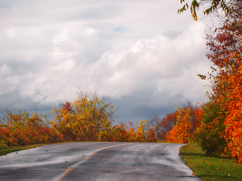
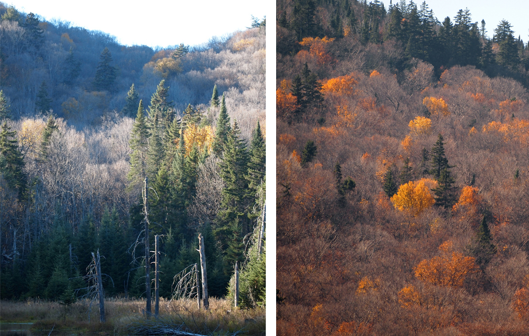
OLYMPUS DIGITAL CAMERA

Ottawa and Gatineau


I just caught the last bit of fall colors in Gatineau and although the peak colors had already passed in the park, the ochres and reds still defined the landscape.

Champlain lookout

Champlain lookout

OLYMPUS DIGITAL CAMERA

Gatineau Park

Winding down a road in Gatineau Park after the rain.

Winding Road in Gatineau Park

In Ottawa the colors were changing a little later though and were in full swing.
PaParliament building in Ottawa
Fall colors in Ottawa


Tremblant 2013

I just got back from Quebec where I spent Thanksgiving with close friends surrounded by fall colors and 20C!

fall leaves

Their Laurentian house, located an hour and half north of Montreal, on the Rouge River, in the township of  Brebeuf,  was engulfed by fog in the early mornings. With the newly fallen leaves it was the perfect picture of Quebec autumn.

fall colors

OLYMPUS DIGITAL CAMERA

Quebec Fall reflections

OLYMPUS DIGITAL CAMERA

Fall landscape in Brebeuf

Hiking in Parc national du Mont-Tremblant provided incredible views and vistas, as well as a bit of exercise.

Lac Monroe in Parc du Mont-Tremblant

Lac Monroe glacier valley in Mont-Tremblant Park

Fall vista in Montr-Trembla Parknt

Quebec fall colors

Quebec fall colors

Along the 3.5km La Corniche trail winding uphill to a spectacular view we encountered the “dino” tree and huge boulders; a boys’ dream playground!

la corniche hike in Mont-Tremblant Park


Fall at the Toronto Zoo

What a perfect fall day for a visit to the Toronto zoo; 30C, sunny and autumn colors everywhere.

My favorite was the unfamiliar sight of african animals amongst fall foliage.

Where else can you see giraffes munching amongst ochre maples, and unique, rare white lions which have not been seen in the wild in over 15 years, pacing past blood red trees.


Newfoundland 2013


Going out to Newfoundland for this year’s show titled Anchor, was yet another amazing and inspiring trip out east. Starting with a great write up in The Telegram , and a successful show, it was followed by unbelievable weather throughout the week…. almost too beautiful; sunny and bright; perfect for hiking. Not quite the moody, foggy landscape that draws me to Newfoundland, but inspiring nevertheless. We visited old friends and met some more wonderful people.


James Baird Gallery in Pouch Cove, NF

The Factory - East Coast Trail

Alexander and I stayed at “The Factory” once again; a former cod liver oil factory with the press still in the basement.

We started our hikes on the east coast trail right from our yard, picking blueberries and chanterelles on the way of course, since it was august, and even had a first run in with a moose on one of the inland trails, Finally, after twelve years of coming to Newfoundland I got to see a moose, snap an unfocused photo and turn right around and leave, abandoning our path.

east coast trail


Benoir Lake

This august took us to yet another cottage, this time on Benoir Lake, on the southern edge of Algonquin park. The mornings greeted us with beautiful mist rising over the water, while the were afternoons with warming sun.

One of the hikes was a gorgeous walk; the trail following an old road through a Red Pine plantation, then becoming a footpath and a bit of a scramble to a rock point north of High Falls. From the end of the trail we had a view of the top of the rapids upstream of High Falls as well as a view downstream towards the falls… and of course a treasure hunt.

…and our collection of treasures grew.

Mayan Riviera

Alexander and I spent a short but relaxing time in the Mayan Riviera with our friends this april.

The highlight was Ek Balam – “Bright Star Jaguar” in Maya language, a Yucatec-Maya recently (and still only partially) excavated archeological site within the municipality of Temozon, from the Preclassic until the Postclassic period – the seat of a Mayan kingdom. In ancient times, it was a large city, controlling a populous and prosperous countryside. The Acropolis houses the possible tomb of king Ukit Kan Le’k Tok’, who ruled from 770 (the starting year of the “height” of this city) to 797 or 802 CE.

  
In this ball court there were a number of discoveries made, among them a collection of burnt stone balls that may relate to the Mayan ball game which we saw in a spectacular show at the Xcaret park.
The Xcaret Park had a numerous animals and a little boy in a red hat weaving in and out amongst the ruins scattered all over the huge park and resort.

The other highlight was a swim in the biggest of Yukatan’s 7000 cenotes. This one: Cenote  Maya, a great natural pool of 80 m diameter with beautiful rock formations and roots reaching down the had a wooden staircase or vines to down into. We opted for the former.